
SuAVE for Environmental Science and the Geosciences
Here are SuAVE application examples in the Geosciences, including collections of rock, macrofossil and coral images, wetland soils, images of sampling sites, and observation systems catalogs. A range of questions can be addressed by exploring these collections, such as factors of coral reef dynamics, spatial patterns in samples of different types, etc. Several of these collections are developed in partnership with the US Geological Survey, British Geological Survey, NOAA, and other organizations
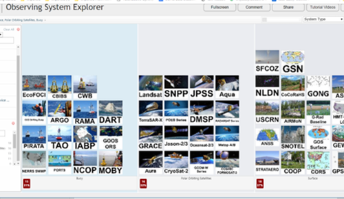
Registry of observing systems.Observing System Explorer, from NOAA.This joint work with NOAA presents observation systems in operation, both government and commercial. You can explore systems of different types by mission service area, topics, measured variables, etc. The application was used in a joint demo with NOAA at the 2017 GEO Summit.
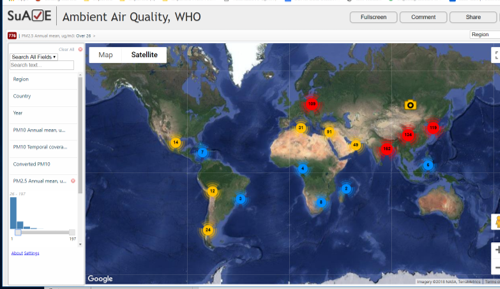
Global air quality.the Ambient Air Quality Database, by country and city, assembled by the World Health Organization. It is available at http://www.who.int/airpollution/data/cities/en/
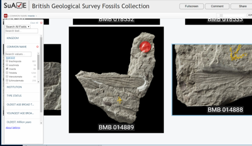
Large geological collection.The Macrofossils Collection from the British Geological Survey. This collection integrates data from several museums. The collection received the 2015 International Data Rescue Award in the Geosciences.
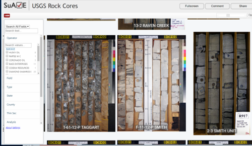
USGS Rock Cores.Rock Cores Collection from the the US Geological Survey's National Geological and Geophysical Data Preservation (NGGDP) program.
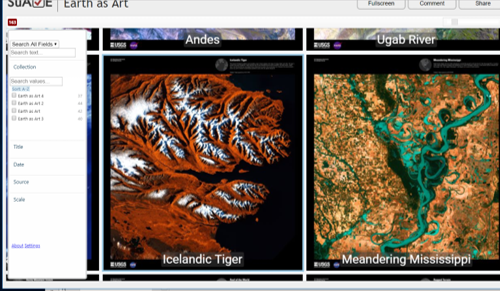
Exploring very large images.Earth as Art. This collection of stunning remote sensing images has been assembled at the USGS EROS data center. It shows images from several missions. The Earth as Art collections 1-4 are included here.
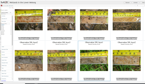
Wetland soil samples.Soil samples from wetlands in the Lower Mekong. The wetland surveys in the Lower Mekong were, conducted under the aegis of Lower Mekong Initiative's (LMI) Wetland University Network (WUN). Data assembled by the Crane Foundation.
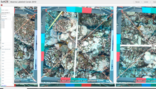
Images of corals.Moorea labeled corals. This coral survey was conducted by Moorea Coral Reef LTER in 2010. The full resolution images were annotated by experts (200 annotations per image at random points, for the 9 most abundant labels, 4 non-coral labels, and 5 coral genera. ).
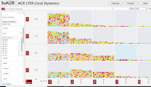
Exploring coral dynamics.MCR LTER Coral Dynamics. This dataset "Coral Reef: Long-term Population and Community Dynamics: Corals, ongoing since 2005 - Percent cover" was downloaded from http://mcr.lternet.edu/data/topic/#biotic_coral. Notice the dramatic change in percentage of stony corals between 2006-2009, during a period of significant bleaching stress.
Additional Geoscience Surveys and Collections
- MagIC Contribution Summaries
- MagIC Photographs of sample sites
- Arctic Great River Observatory data
-
R2R (Rolling Deck to Repository): a catalog of Research Cruises.
Also see
with ship photos
Explore the track lines on a map . - Archived Rock Samples From Jane Selverstone's Research Collection, UNM.
- Tools for Microscopic Identification at the National Lacustrine Core Facility, LacCore, Univ of Minnesota Click ImageSieve in the menu to see SuAVE (an earlier version)
- Publishing and Intuitive Visual Analysis of Rock Samples in Large Geologic Repositories, AGU Abstract .